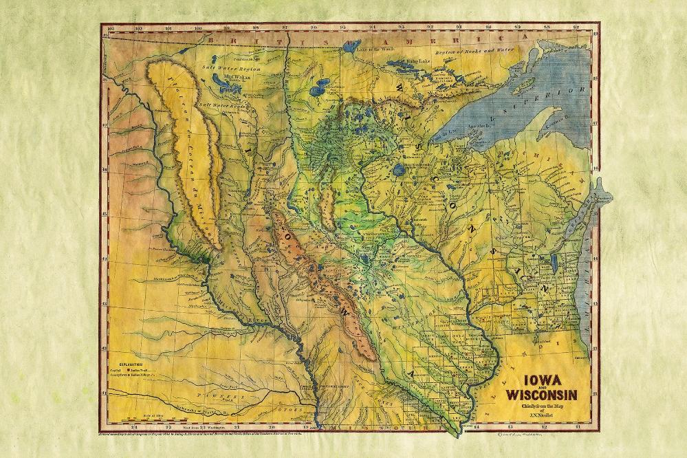
056 Iowa/Wisconsin 1844
This is a tremendous map of Wisconsin and the Upper Plains, following the Missouri River beyond Ft. Mandan and the Little Missouri to the White Earth River.
The map is based upon JN Nicollett's map of the Hydrographical Basin of the Upper Mississippi and Missouri, the single most map of this region during the period. A hand full of early counties in Wisconsin and Iowa appear, with Iowa extending to the Canadian Border. The detail between the Mississippi and the Missouri is extraordinary for the period. Lots of Indian and early American Fort and exploration details throughout. Indian Trails and Villages are also noted.
Morse & Breese's North American Atlas was a landmark in American Cartography, being the first atlas to employ the cerographic printing process, which would revolutionize the map trade. The Morse family and this process are the subject of David Woodward's The All American Map. The maps were first printed in a series of inserts which appeared in the New York Post, and then later as a separate atlas.
This is an essential map for American Map collectors, illustrating an important change in the history of printed maps and the only truly American cartographic publishing innovation.
All sizes are approximate.